I really like maps. I have a small hiking book for the area and a book of hikes. When I am riding in my daughter’s care, I admire a map of Colorado, a geologic highway map and shaded elevation map. My daughter says, “You gave that to me when I moved to Denver. Take it!” She doesn’t like extra stuff. Use it or lose it.
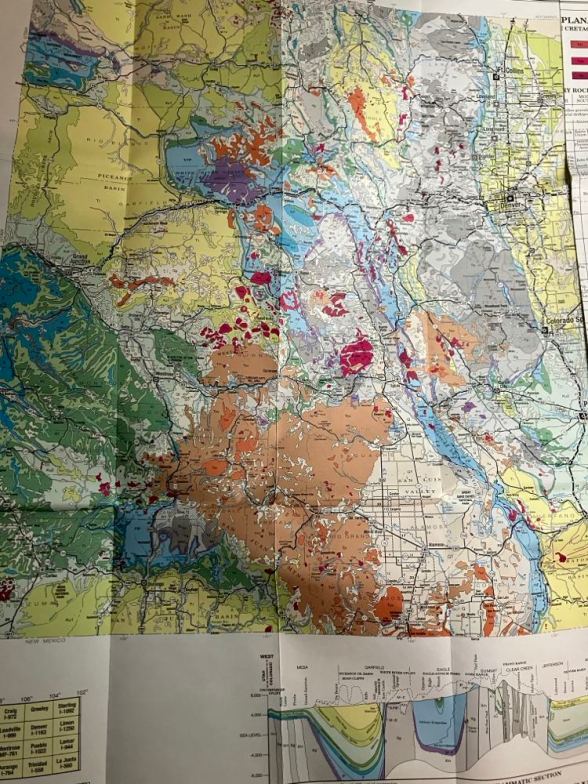
The geologic side fascinates me. It shows color coded zones of different rock formations and has some history. Rocks and mountains, delightful!
Some of the hikes here are also mountain bike trails and loop in all sorts of ways. I try to remember to photograph the map at the start of the hike, so that I can refer to it on my phone. Lots of hikes are out of the range of phone towers, so I won’t depend on GPS!
Grand Junction lies in the Grand Valley and runs mostly east/west along the Colorado River and Interstate 70. They have named the streets on a grid with letters and numbers. This has some odd charm: I live off of 21 and 1/2 road, which is 21 and 1/2 miles from the Utah border. There are some 1/4 and 3/4 roads too. The lettered roads start with A at Orchard Mesa. There is an F and 1/2 road. How fun! There is also a downtown switch, where suddenly the numbered roads go from 1 to 7 and drop out of the numbers set from the Utah border. There is an article explaining here.
The photograph is part of the Colorado Geologic Map. The altitude map is on the other side. Isn’t it pretty?
For the Ragtag Daily Prompt: guide.


You must be logged in to post a comment.